Conservation Corner: How We Use GIS
The art of cartography has been updated and tweaked through the years as humans have advanced. Even now, mapping is changing and adjusting to our digital world. Here at Fontenelle Forest, we have implemented a geographic information system (GIS) mapping program. Basically, GIS is a way to create, store and use maps based on real-world, on-the-ground locations tracked by a Global Positioning System (GPS) unit. While we work and manage the Forest, trails, boardwalks, etc., we “mark” specific locations with the GPS unit that sends signals to satellites, which then are transposed and transmitted back to our GPS unit. We input the GPS data into a program called ArcMaps, and by georeferencing our data, we have a more accurate picture of where things are happening out in the forest.
So what do we do with all this data and these maps? The most commonly used map at Fontenelle Forest is the trail map (Image 1). We are updating it with the GPS-tracked trails, and have found that we have about 8 miles of trails at Neale Woods and 17 miles of trails at Fontenelle Forest. However, as we relocate, close and open new trails, these numbers will change. By using GIS, it is easier to change a map and be more accurate about the portrayal of our trails on paper.
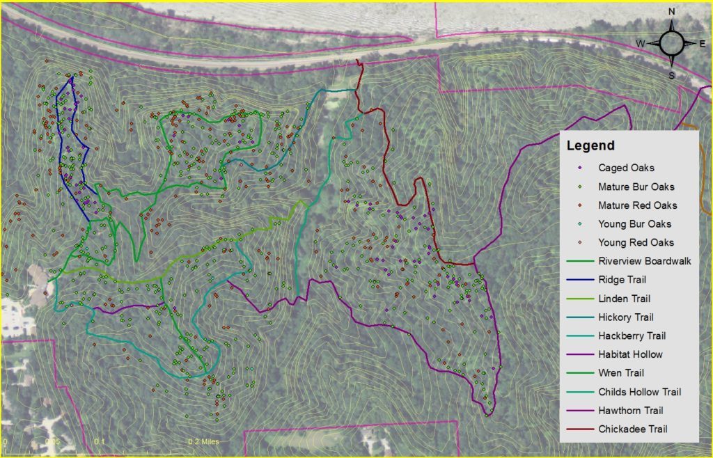
During our restoration work, which is partially funded by the Nebraska Environmental Trust, we collect data to create several types of maps. We compile information from various sources to visually display the historic land use which helps us plan future land management, and to divide the land into management units. We can also pinpoint historical and archeological sites which require special consideration during our land management activities. Our rare and invasive plants, as well as oak trees (Image 2), can be tracked temporally and spatially, which helps us monitor restoration efforts and helps us prioritize our work. When we conduct our plant, migratory bird, and insect surveys, we return to the same spots every year and use our software to track the monitoring results.
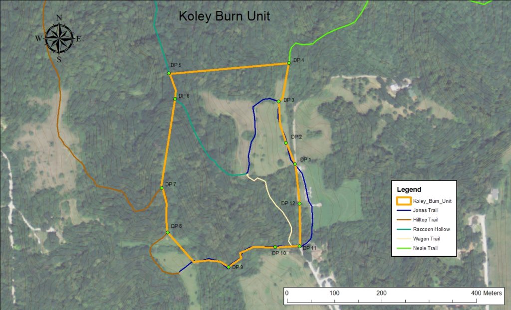
When we conduct a prescribed burn, we use GIS to map the unit (Image 3) including fire breaks, special interests (i.e. fence posts, signage), drop points, acres to be burned and bordering landowners. Different burn units may require different types of management, and our units may change over time, as well. By using GIS, we have a relatively easy way to change, track, and measure all of this information.
The vast quantities of intelligence that we gather and work with can be overwhelming, but with the tool of GIS, we can not only see what is going on, but analyze it as well. That, in turn, leads to a more enjoyable experience for everyone using Fontenelle Forest land!
Michelle Foss, Restoration Biologist